FEBRUARY 2017
 |
| NEAR THE TRAILHEAD |
 |
| CHINOOK FALLS |
 |
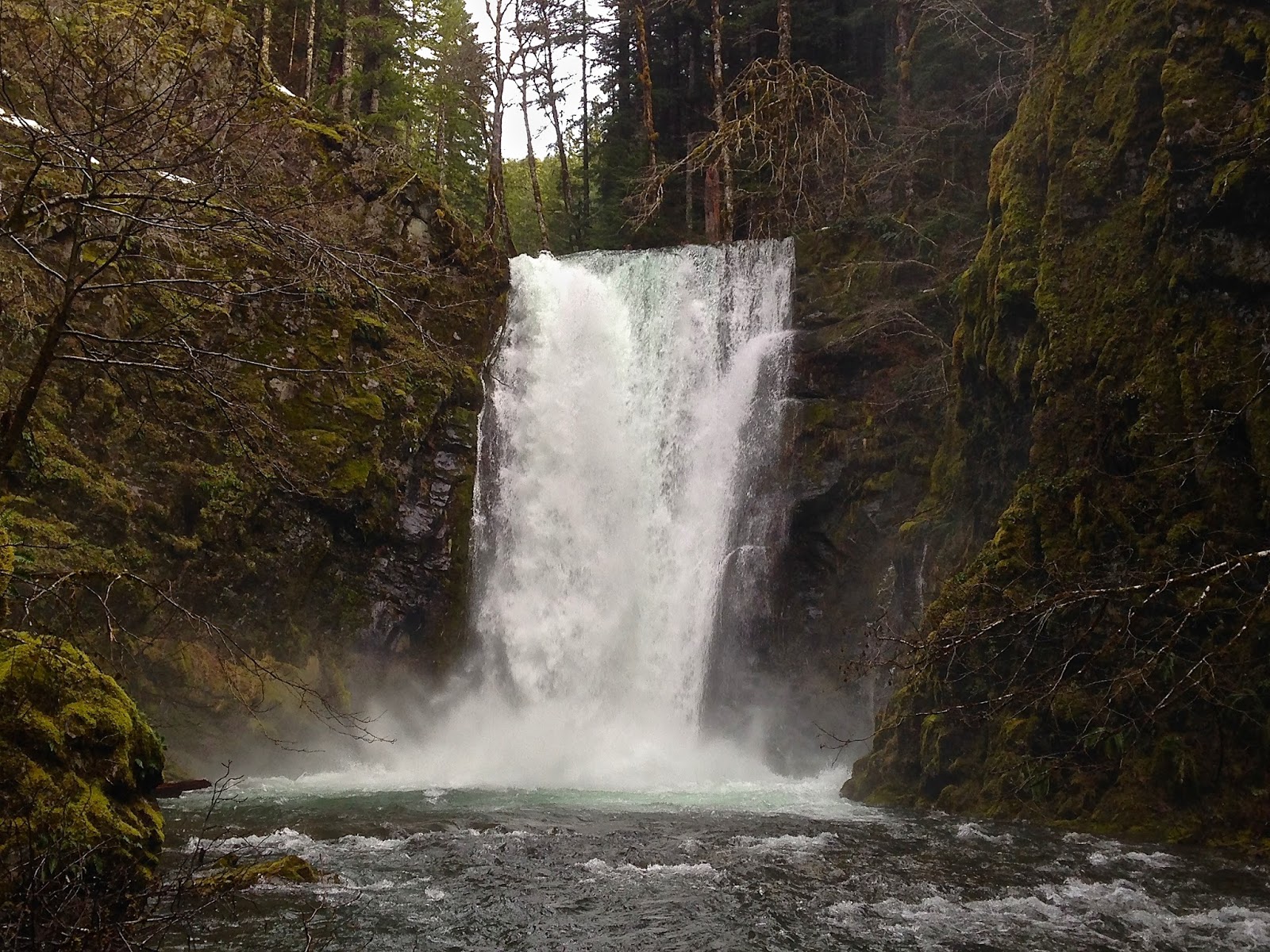
| HORSESHOE CREEK FALLS |
 |
| HORSESHOE CREEK FALLS |
 |
| HORSESHOE CREEK FALLS |
 |
| SIOUXON CREEK NEAR SIOUXON FALLS |
 |
| SIOUXON CREEK |
 |
| SIOUXON FALLS |
 |
| WILDCAT FALLS |
Siouxon Creek is a beautiful 9.8 mile round-trip hike located about half-way in-between the Columbia River Gorge and Mount Saint Helens. This hike was just barely accessible when I attempted it over Presidents Day weekend in February of 2017. As you approach the trailhead, the road turns to gravel and drops steeply down towards Siouxon Creek. I must have been one of the first people to access this hike that year, as there were several large trees fallen across the road. Near the start of the gravel road, a large tree had fallen across the roadway leaving a clearance of only about 5' on one side of the road. Luckily I was driving a Toyota Corolla and was just able to squeeze under the tree. Any car over about 5' tall wasn't able to proceed past this point.
Portions of the roadway were covered in snow and ice, and another tree had fallen across the road leaving only about 6' or 7' of width to pass around at one point. It was one of those rare occasions where the road was so rough, only tiny cars were able to access the trailhead (on my way out I saw an SUV that unable to make it under the first fallen tree). Eventually another fallen tree completely blocked the road to travel, but as I was only about 2 miles from the trailhead I decided to go ahead and hike it, making for about a 14-mile roundtip hike. I'm glad I did as this trail really impressed me.
The trail drops down to Siouxon Creek and follows it along through some very lush forest until reaching Horseshoe Creek Falls and then Siouxon Falls, which were both running very high. A little past Siouxon Falls, the trail became covered in snow, which was a couple feet deep in places. This slowed me down, but I was still able to follow the trail, so I continued on to Chinook and Wildcat Falls. There was a creek crossing between Siouxon and Chinook Falls that was a bit rough due to the snow and high water, but this would probably not be a problem later in the year. The benefit to hiking this trail in February was that I had it entirely to myself, and was able to see falls running at a high capacity. However, if I were to do it again, I would wait until a little later in the year to hike it.